Offline Maps for the Backcountry Enthusiast
Have you ever wanted to turn your Android phone into a true GPS device? Online mapping services will fail in remote areas and current Garmin 100k topo maps don't match the clarity that Google Terrain maps offer. If you have been looking for high quality topographical and earth satellite maps for track logging your next hike, skiing trip or back-country exploration then this site will help you get started quickly if you are mapping within the very specific database of maps we have available. New maps are being added periodically based on popularity.
Can I make my own maps? You can, however reliable map sources are become more scarce. In order to create maps compatible with a mapping application for your android smartphone you can do one of two things.
- Obtain a map somehow and then use specific software to painstakingly align and calibrate the map so that your gps software can use it as an overlay
- Have a way of downloading consecutive map tiles from one of the map sources on the internet and formatting them into a compatible format
Since I am not interested in road maps, the availability of map good sources for backcountry exploration is limited to say the least. Microsoft Virtual Earth, Google Terrain and Earth are three of the best sources for these maps, most notably the Terrain maps offered by Google.
Software was built to download these tiles, order them and output them into a format that your mapping software can read. Unfortunately, many of the online map sources have begun to request to the individual that develops the map downloading software MOBAC that they remove the programs ability to pull map tiles from their servers. In early 2012, Google made a change that restricted your ability to download map tiles from their google earth and terrain database. Fortunately there are still ways to allow us access to this important service.
I created this website to offer a simple path for a new offline maps user to gain access to regional maps which are become increasingly difficult to obtain. The map archives collected on this site are compilations of map tiles that I have downloaded and created for my own use and to share with the community. In order to use these maps you will need the following:
- Android Phone (wireless service not required)
- Orux Maps Installed (free from droid marketplace) http://www.oruxmaps.com
- Ability to download, extract a zip and copy the files to your phone
After trying several android mapping applications I settled on OruxMaps and have been very happy with the software, which is offered for free download in the Android Apps Market.
Future Map Availability
All maps were downloaded using Mobile Atlas Creator 1.8 and created custom for OruxMaps. Version 1.8 is an old version of MOBAC which has all map sources listed. The latest versions have the best sources removed because in 2011 the companies who own the tile databases requested that MOBAC remove their database from the source list. This effectively prevents the newer versions from being able to download the thousands of consecutive map tiles. This activity taxes their servers well beyond a normal user. By sharing our pre-downloaded regional maps we can reduce the load on these servers by offering our map files for others to use. If you have a source to contribute contact the webmaster.
Maps available on this site:
contact me if you have questions about obtaining maps
Northeast Essentials
VT NH Adirondacks Terrain [567mb] [map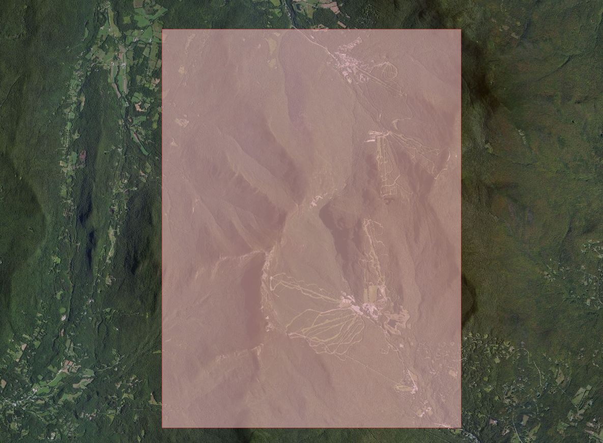 ]
]
Maine Terrain [699mb] [map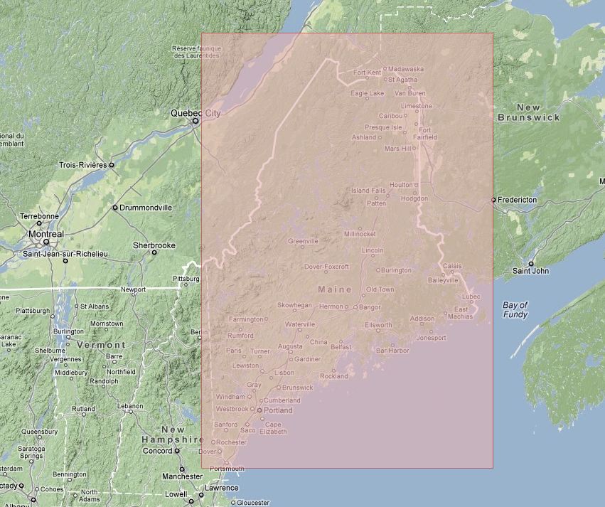 ]
]
New Hampshire Snowmobiling
Errol Pittsburgh NH Snowmobiling Earth [1.19gb] [map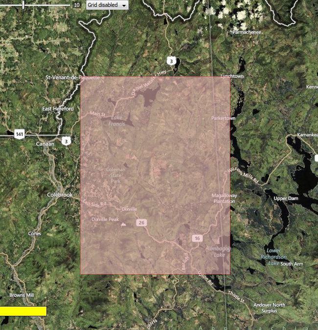 ]
]
Cities
Burlington Vermont City Earth [247mb]
East Coast Ski Destinations and Resorts
Maine Sugarloaf Burnt Mountain Expansion Earth Terrain [145mb] [map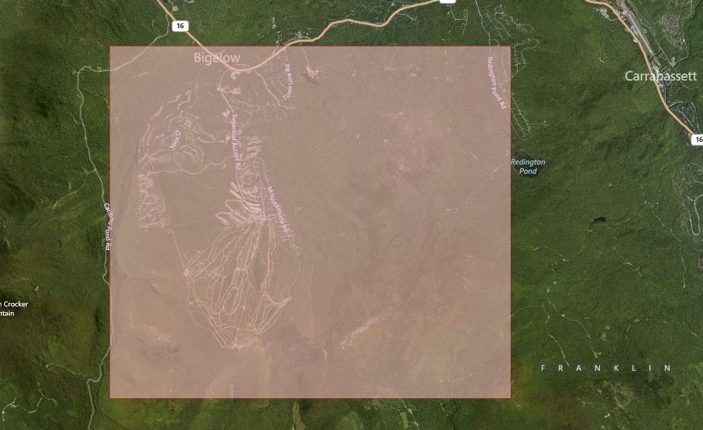 ]
]
New Hampshire Canon Mountain Resort Earth Terrain [64mb] [map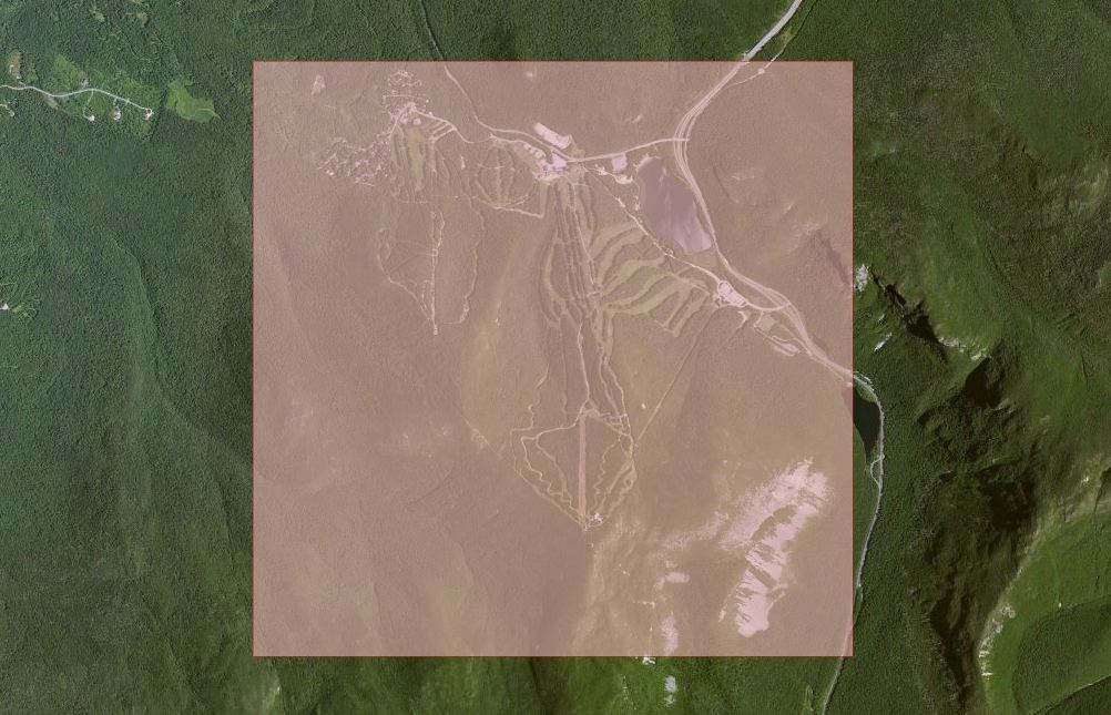 ]
]
Vermont Jay Peak Resort Earth [585mb] [area map] [map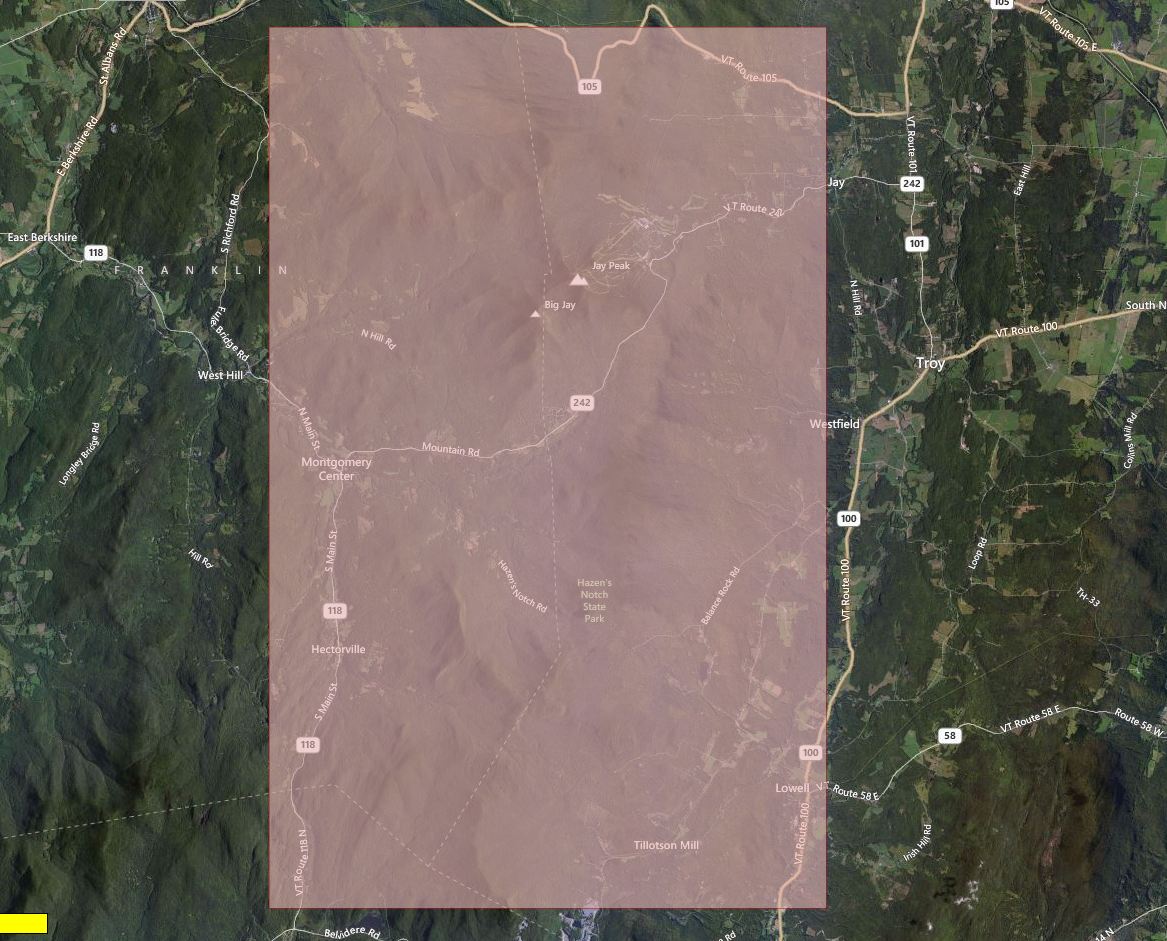 ]
]
Vermont Mansfield Stowe & Smuggs Earth Terrain [248mb][map]
Vermont Killington & Pico Earth Terrain [287mb][map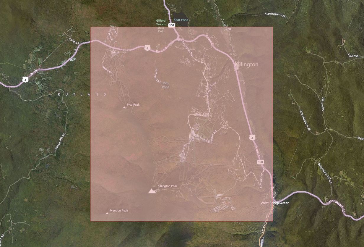 ]
]
West Coast Ski Destinations and Resorts
Brittish Columbia Vancouver Whistler Terrain [548mb] [map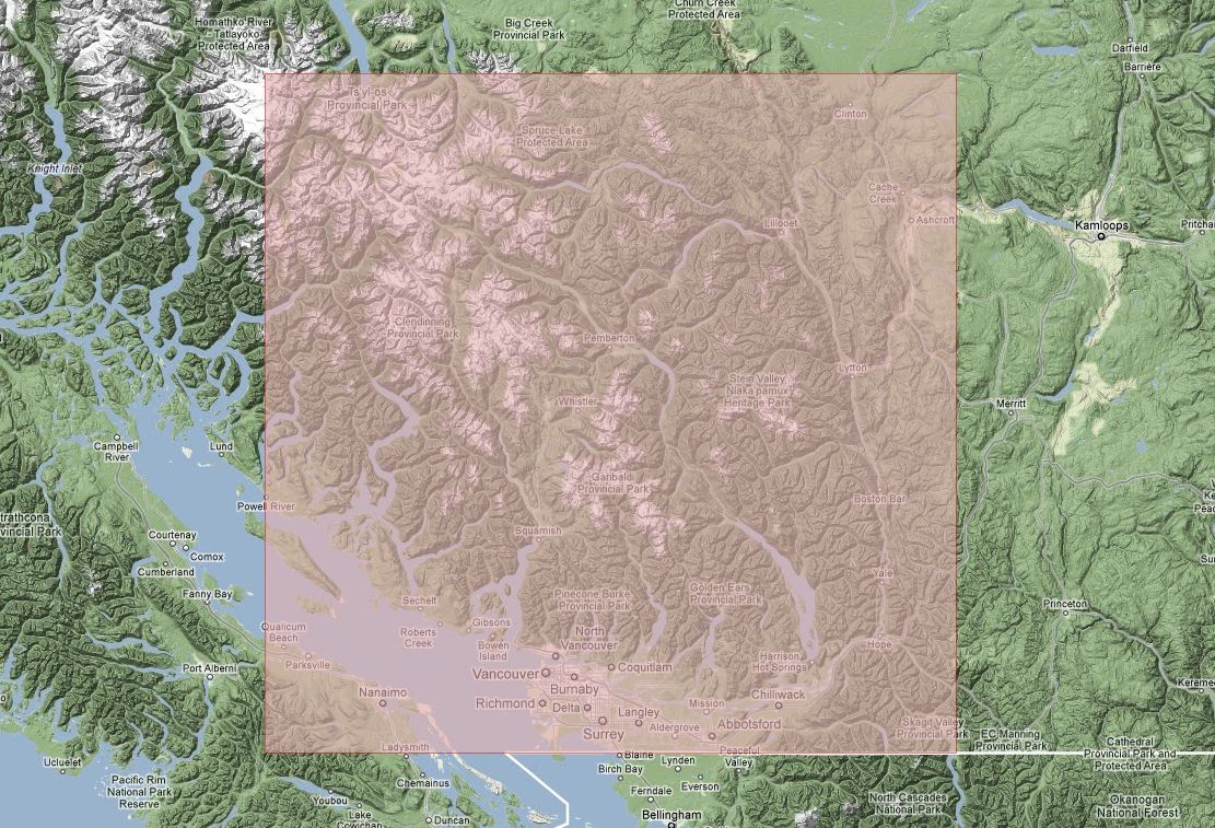 ]
]
California Lake Tahoe Earth Terrain [769mb] [map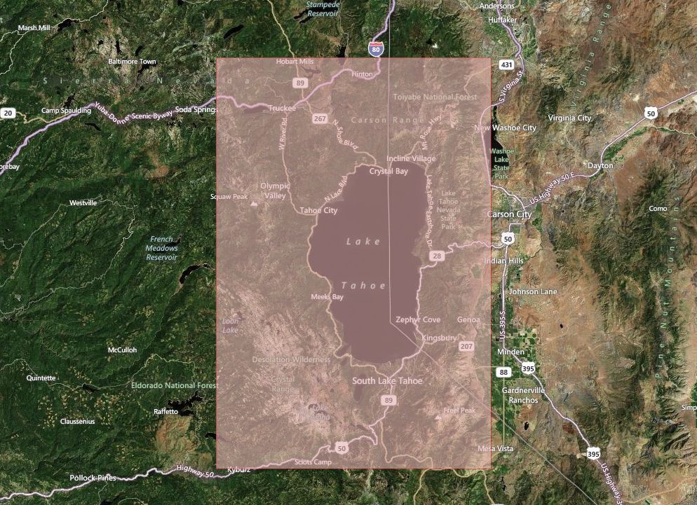 ]
]
Colorado Steamboat Springs Terrain [222mb] [map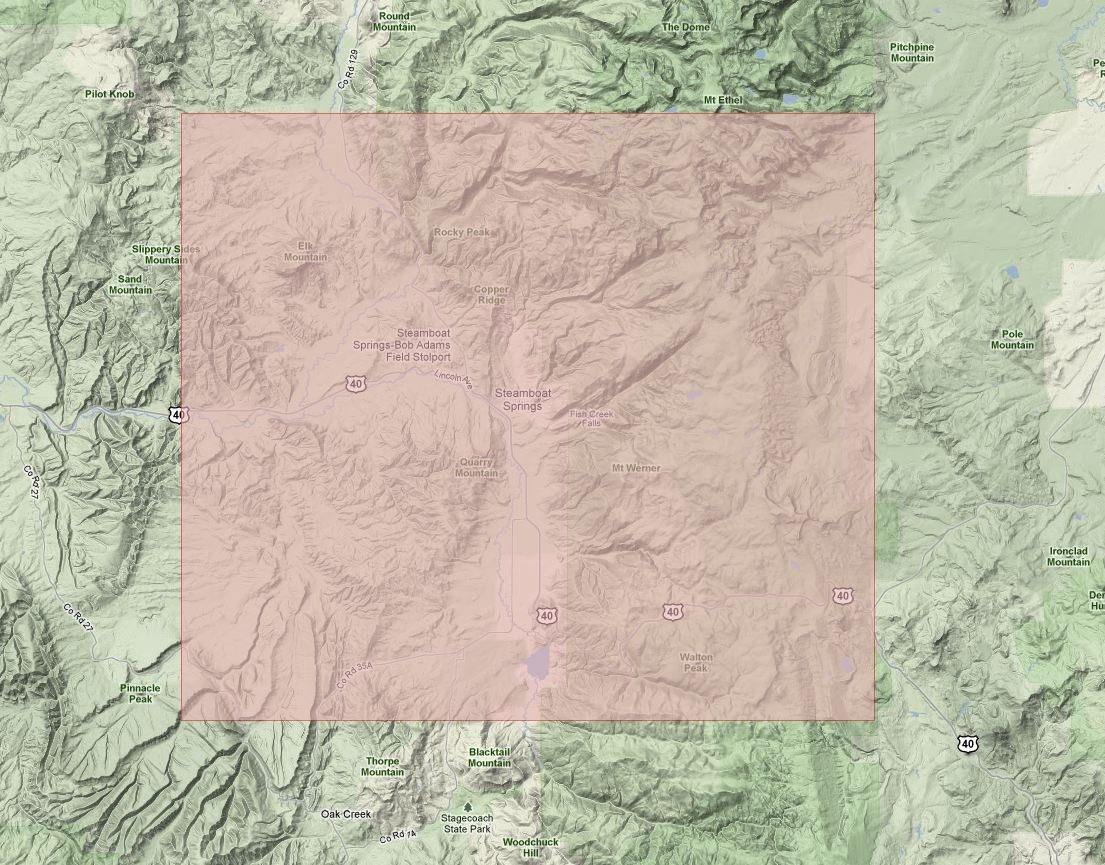 ]
]
Colorado Telluride San Juans Earth Terrain [666mb] [map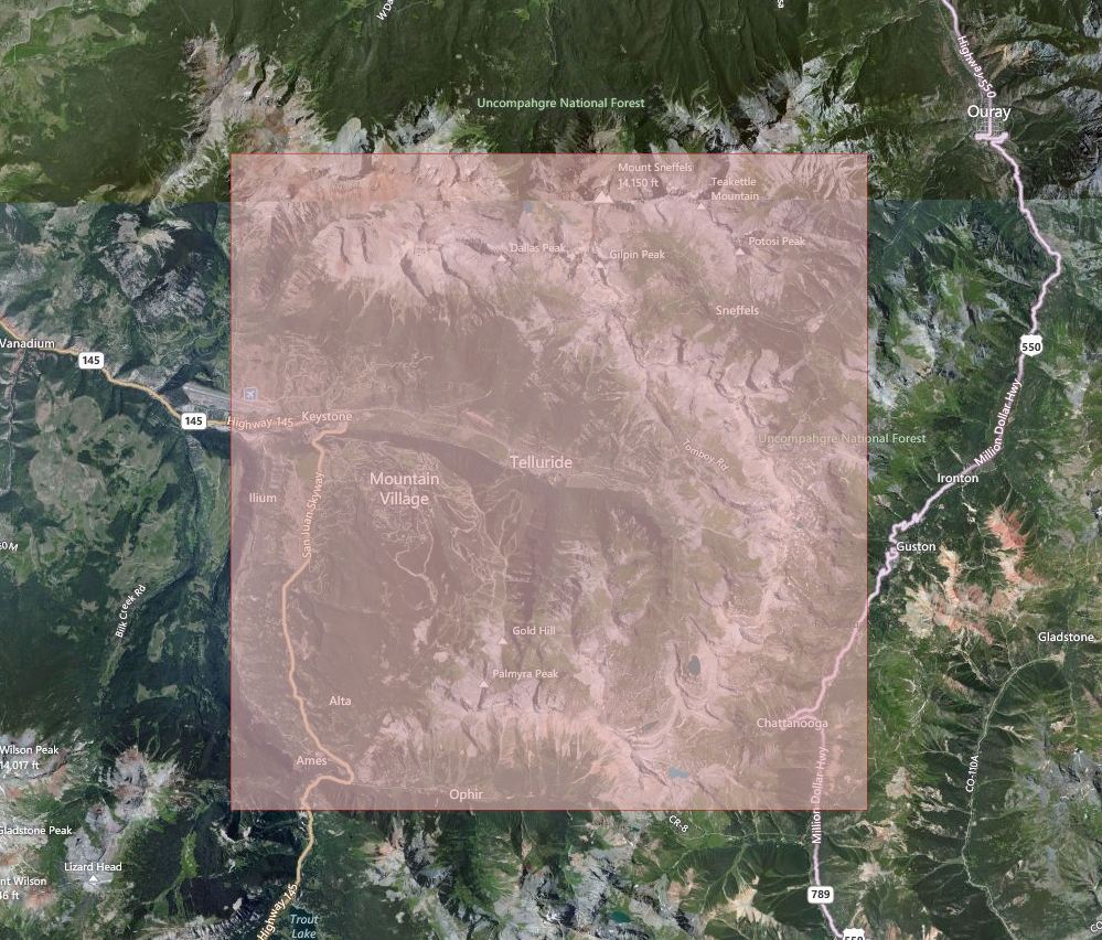 ]
]
Oregon Mount Hood Earth Terrain Earth Terrain [292mb] [map earth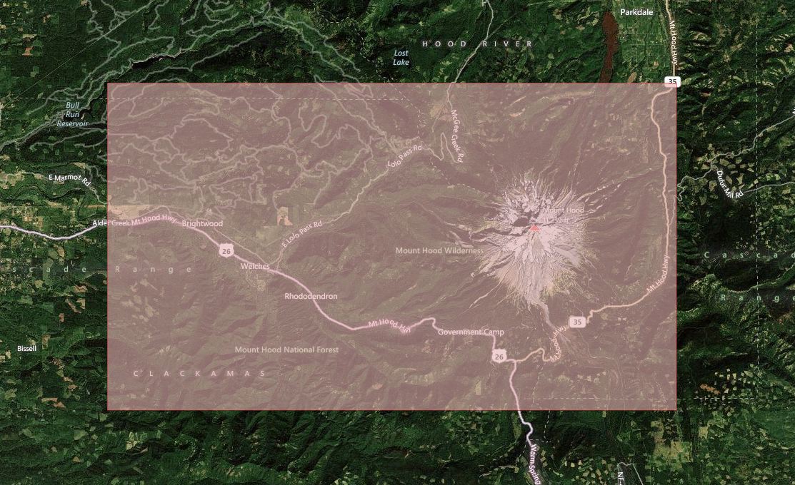 terrain
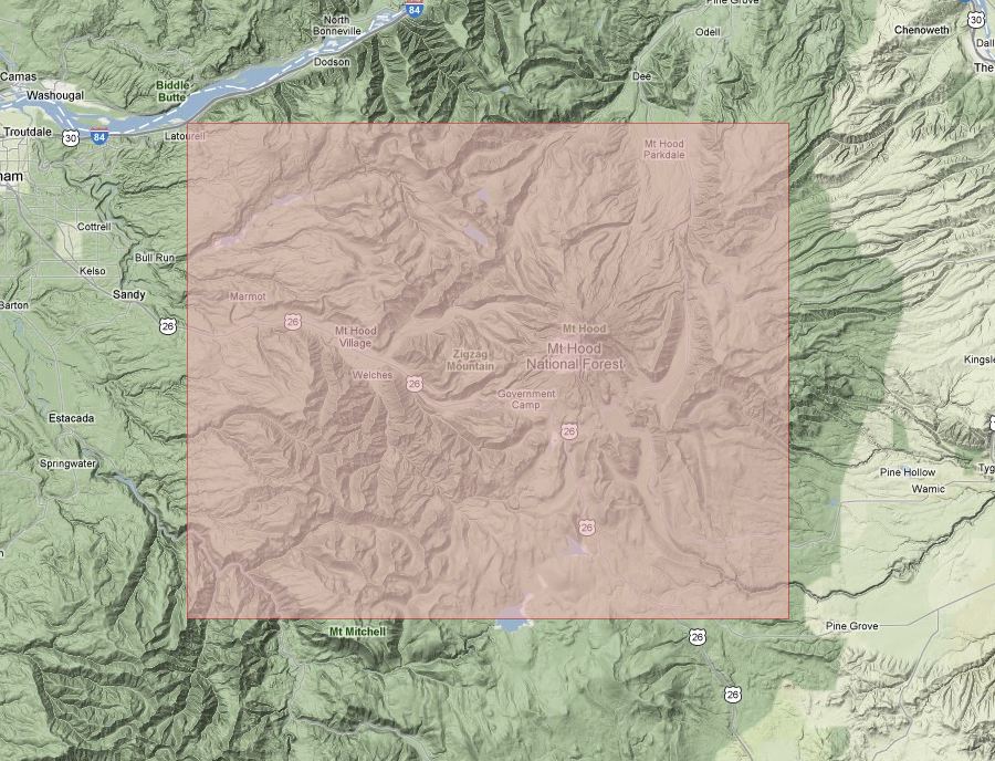 ]
]
Montana Bozeman Bridger Bowl Earth Terrain [388mb] [map ]
]
Utah Snowbird Alta Park City Earth Terrain [1.13gb] [map earth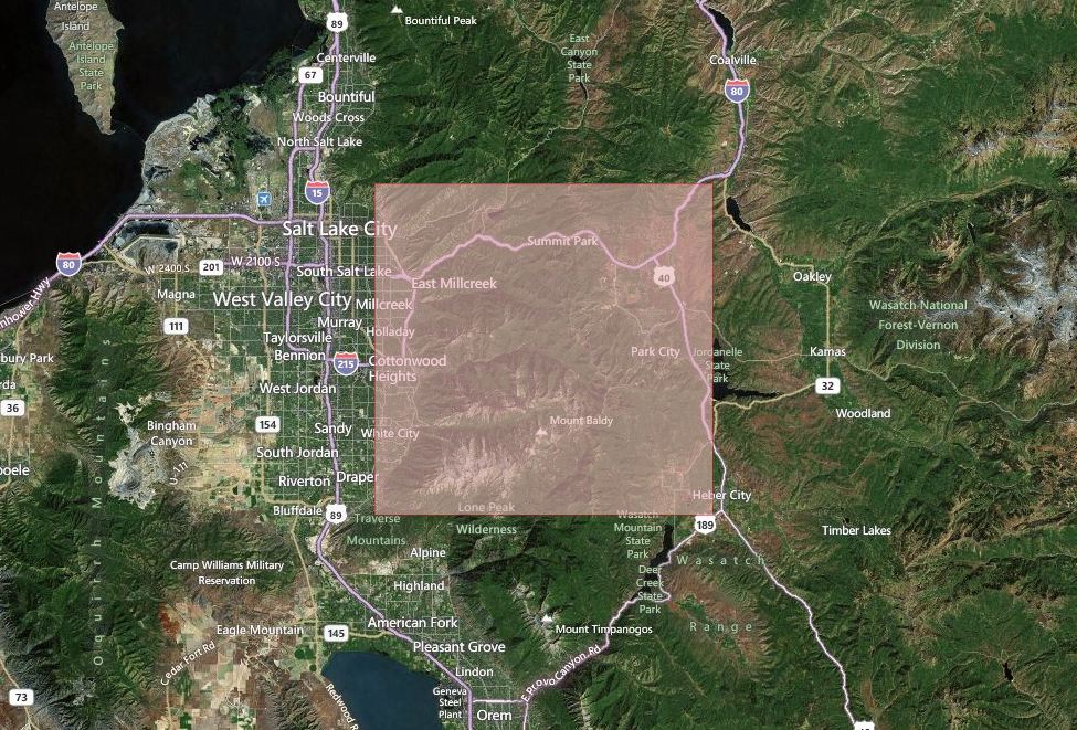 terrain
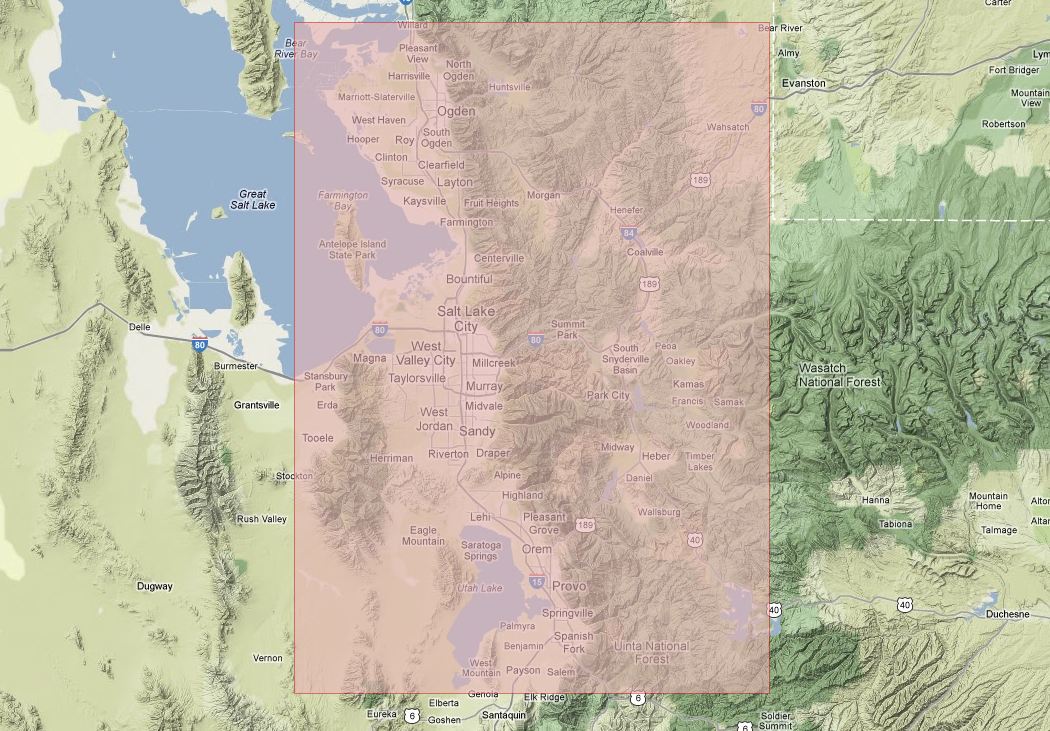 ]
]
Wyoming Teton Mountain Range Earth Terrain [637mb] [map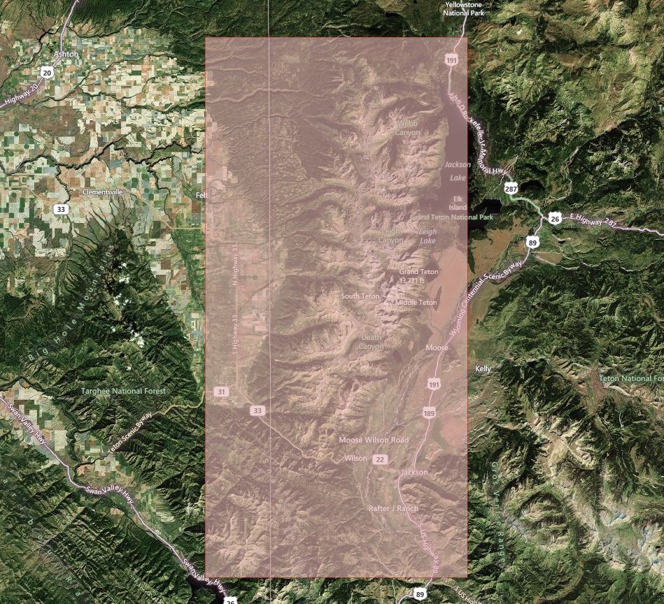 ]
]
Instructions for Loading Maps:
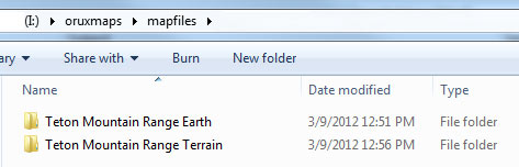
After you have Orux Maps installed on your Droid phone, locate the following folder and extract the maps to a folder within this directory. Each map source that you obtain from this site, wheter Earth, Terrain or both, requires that it have its own folder within MAPFILES.
Folder Structure: \oruxmaps\mapfiles\MAP SOURCE FOLDER
Example: If you download 'Teton Mountain Range Earth Terrain.zip' it will extract into two folders as shown below. If you only wish to use one of the two map sources then you only need to copy the map source folder that you plan to use to your oruxmaps/mapfiles folder. There cannot be another folder between the Earth & Terrain folders and the mapfiles folder. Earth and Terrain are considered two seperate map sources and should be structured accordingly.
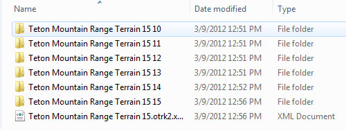
When clicking into the terrain folder above the structure will appear as follows. Each number value (e.g. 10 through 15) represents the set of tiles that are provided as part of the map source. The higher the number the greater the resolution and the higher the file count.
/oruxmaps/mapfiles/Teton Mountain Range Terrain/
How to create Offline Map files for OruxMaps using Mobile Atlas Creator
Map sources can be created by using Mobile Atlas Creator, however as discussed earlier the sources for map tiles are quickly dissapearing. See Future Map Availability. To create Maps with MOBAC you select the map source, the area you wish to download maps for, name the project, add the area to the queue and then select the format of OruxMaps. Once that is done you click 'Create Atlas' and the download and processing begins.
This link will take you to a quick & dirty PDF that helped me get started using MOBAC